Vang Vieng (Vangviang)
Vang Vieng (ວັງວຽງ) is a tourist-oriented town in Laos in Vientiane Province which takes about four hours through bus from the national capital Vientiane. The town lies on the Nam Song River. The most notable feature of the area is the karst topography surrounding the town.
Vang Vieng was first settled around 1353 as a staging post between Luang Prabang and Vientiane. Originally named Mouang Song after the body of the deceased King Phra Nha Phao of Phai Naam was seen floating down the river, the town was renamed Vang Vieng during French colonial rule in the 1890s.
Significant expansion of the town and its infrastructure occurred during the 1964-1973 Vietnam War when the US constructed an air force base and runway that was used by Air America. The airstrip was then called "Lima site 6". The runway has not been built on and can easily be seen via aerial or satellite images located between the main street and the national highway (Route 13). American plane shelters also remain in the area.
Since Laos opened up for tourism in the late 1990s, the town has grown substantially due to the influx of backpacker tourism and associated business development. The town became an established tourism center due to the opportunities for adventure tourism along the Nam Song River and in the spectacular limestone karst landscape surrounding the town.
Map - Vang Vieng (Vangviang)
Map
Country - Laos
 |
 |
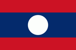
| Flag of Laos | |
Present-day Laos traces its historic and cultural identity to Lan Xang, which existed from the 13th century to the 18th century as one of the largest kingdoms in Southeast Asia. Because of its central geographical location in Southeast Asia, the kingdom became a hub for overland trade and became wealthy economically and culturally. After a period of internal conflict, Lan Xang broke into three separate kingdoms: Luang Phrabang, Vientiane and Champasak. In 1893, the three territories came under a French protectorate and were united to form what is now known as Laos. It briefly gained independence in 1945 after Japanese occupation but was re-colonised by France until it won autonomy in 1949. Laos became independent in 1953, with a constitutional monarchy under Sisavang Vong. A post-independence civil war began, which saw the communist resistance, supported by the Soviet Union, fight against the monarchy that later came under influence of military regimes supported by the United States. After the Vietnam War ended in 1975, the communist Pathet Lao came to power, ending the civil war. Laos was then dependent on military and economic aid from the Soviet Union until its dissolution in 1991.
Currency / Language
| ISO | Currency | Symbol | Significant figures |
|---|---|---|---|
| LAK | Lao kip | â‚ | 2 |
| ISO | Language |
|---|---|
| EN | English language |
| FR | French language |
| LO | Lao language |


